This Page is constantly being updated as the Site is being developed.
Please a) Return frequently to see the changes, and
b) Use the 'Contact Us' button to suggest additions to this page.
The Beginning ...
How did SOFAR come into being in Bermuda in 1948?
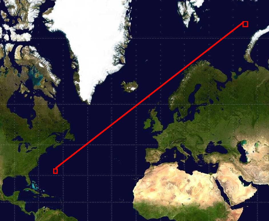
Mercator Projection 'Wall Map'.
|
The ‘story’ goes that some big brass in the US military looked at a wall map of the world and decided that there was a clear, straight-line underwater path between Bermuda and the
Russian underwater nuclear test site off the North coast of Russia, and that Bermuda would be an ideal place to install an underwater listening station. |
|
But wall maps are most commonly Mercator projection, and what appears to be a straight line journey on the map would in reality be a journey along a curved path, whereas a straight line journey in a boat (what is known as a 'Great Circle' route) would appear as a curved line when plotted on a Mercator projection map.
So, in reality, Newfoundland, Greenland, and a few other –lands, would get in the way of the straight line path of the sound of any explosion from North Russia to Bermuda. |
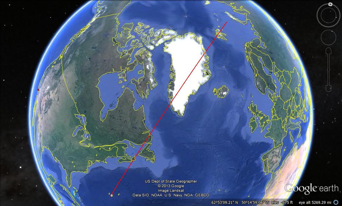
Straight line Great Circle Route.
|
Was this ‘story’ the truth?
Probably not, but it was a good cover for the real story. The average Joe could look at the ‘by far most popular’ Mercator projection world map, and be convinced of that story.
It was common knowledge that the Super Powers were advancing from atomic bombs into nuclear bombs, and it’s very hard to conceal the sound and vibration while testing such weapons. So the cover story made sense. Everybody knew all about weapons testing, so this 'story' must be true!
This was 1948, just 3 years after the end of World War II, and the super-powers were flexing their muscles, and posturing for world domination. In divvying up the German war-spoils, it appears that the Americans ran off with the rocketry expertise, while the Russians snatched the submarine expertise. (I find it interesting, therefore, that Russia was first in space, while America developed far superior submarine systems, both offensive and defensive! Just my personal opinion.)
What was not generally publicly known, was the extent of the muscle-flexing under the waves. Conventional warhead missiles had been developed, and the Russian Navy was quick to arm its subs with them. Their range was not very great, so the subs needed to get very close to the East Coast in order to pose a threat to the US, the prime target being Washington. Bermuda was in an ideal location to act as an ‘early warning’ base for any subs coming across the Atlantic trying to avoid the listening stations off Newfoundland and the East Coast.
So, in 1949, the SOFAR geophone was installed, and the rest, as they say, is history!
. ~~~ooo000OOO000ooo~~~
1948. |
Sofar Station established.
|
|
1949.
|
Geophone Installed.
|
|
1958
|
Project Hose started. Research project that eventually became SURTASS.
|
1967 |
Big Gun. Research prior to SMILS project
TOTEM Project. Research prior to Thermistor Train development. |
|
1968
|
March/April. Anti-VietNam War student demonstrations at Columbia University leads to the decision by Columbia to terminate funding of Columbia University Geophysical Field Stations (SOFAR Station, Canary Island Station, and Lamont). Palisades Geophysical Institute (PGI) created. Funding from ONR directed to SOFAR Station via PGI.
|
|
1973
|
Gordon Hamilton Leaves SOFAR. Moves to ONR in Washington D.C. Carl Hartdegen assumes Position of Director of PGI.
|
1982 |
SOFAR Station Closes. Operations move to Florida
|
|
1991
|
Feb. Carl Hartdegen dies of a heart attack . Tom Graves becomes Director of PGI (Florida).
|
|
2001
|
Oct. PGI loses contract with the Navy. PGI operations cease.
. The End. |